

Here's what to expect and when
Update 5:42pm: A very powerful storm is moving through parts of Saratoga, Warren, Washington and Rensselaer Counties, warnings of wind gusts near 80mph
Severe Thunderstorm Warning continues for Bennington VT, Hudson Falls NY and Ballston Spa NY until 6:15 PM EDT. This destructive storm will contain wind gusts to 80 MPH! pic.twitter.com/pHLTgfqHGC
— NWS Albany (@NWSAlbany) July 16, 2024
Update 5:32pm: A Severe Thunderstorm Warning has been issued for Saratoga, Warren and Washington Counties
Severe Thunderstorm Warning including Albany NY, Troy NY and Watervliet NY until 6:15 PM EDT pic.twitter.com/HHWbXLjdoT
— NWS Albany (@NWSAlbany) July 16, 2024
Update 5:26pm: Fans at SPAC for Third Eye Blind are being asked to shelter in place
Embed not found
Update 5:09pm: The latest radar map from the National Weather Service shows strong storms moving through Warren and Saratoga Counties. Damage from 70mph winds has also been reported.
Severe thunderstorms continue to move eastward across the area. We have received several reports of wind damage and measured wind gusts over 70 mph. Please move to a safe interior place as these storms approach. pic.twitter.com/KueUDo8o4v
— NWS Albany (@NWSAlbany) July 16, 2024
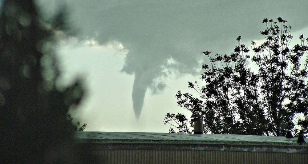
Update 5:01pm: A Tornado Warning has been issued for the following areas, according to the National Weather Service
* Tornado Warning for...
  Central Warren County in east central New York...
  Saratoga County in east central New York...
  Washington County in east central New York...
  Northeastern Rensselaer County in east central New York...

* Until 530 PM EDT.

* At 451 PM EDT, a severe thunderstorm capable of producing a tornado
  was located 9 miles north of Day Center, or 15 miles west of
  Warrensburg, moving east at 50 mph.

  HAZARD...Tornado.

  SOURCE...Radar indicated rotation.

  IMPACT...Flying debris will be dangerous to those caught without
           shelter. Mobile homes will be damaged or destroyed.
           Damage to roofs, windows, and vehicles will occur.  Tree
           damage is likely.

* This dangerous storm will be near...
  Warrensburg around 505 PM EDT.
  Lake George Village around 510 PM EDT.
  Comstock around 525 PM EDT.

Other locations impacted by this tornadic thunderstorm include Parkis
Mills, Deans Corners, Grangerville, South Bay Village, Glenwild,
Northumberland, Wayville, Wiley Corners, Middle Falls, and Halls
Corner.
Update 4:44pm: A Severe Thunderstorm Warning has been issued for parts of the area, the NWS warns of 70mph wind gusts
Severe Thunderstorm Warning including Amsterdam NY, Gloversville NY and Johnstown NY until 5:15 PM EDT. This storm will contain wind gusts to 70 MPH! pic.twitter.com/ky6DbR20QM
— NWS Albany (@NWSAlbany) July 16, 2024
Update 4:26pm: The National Weather Service has issued a Tornado Warning for Gloversville, Johnstown and Broadalbin until 5pm
Tornado Warning including Gloversville NY, Johnstown NY and Broadalbin NY until 5:00 PM EDT pic.twitter.com/CmvhvwllpH
— NWS Albany (@NWSAlbany) July 16, 2024
Update 3:59pm: The National Weather Service has issued a Tornado Warning for southwestern Hamilton, southern Herkimer and western Fulton Counties until 4:45pm.
\Update 2:35pm: The National Weather Service has issued a Severe Thunderstorm Watch for the Capital Region and parts of Massachusetts and Vermont until 9pm.
A severe thunderstorm watch has been issued for parts of Massachusetts, New York and Vermont until 9 PM EDT pic.twitter.com/m5iyg9poyM
— NWS Albany (@NWSAlbany) July 16, 2024
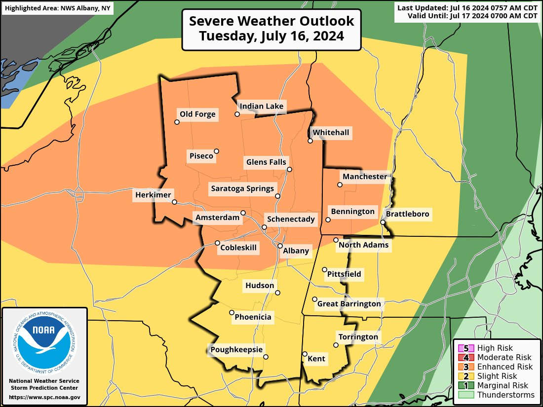
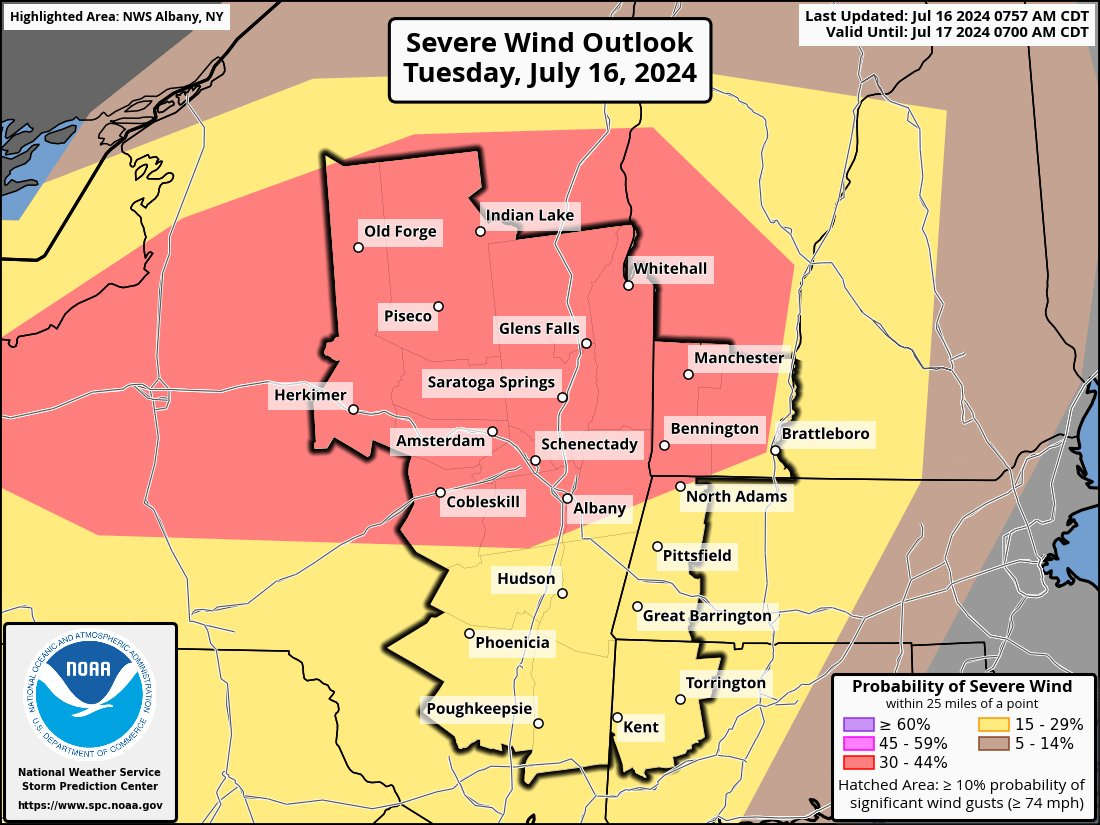
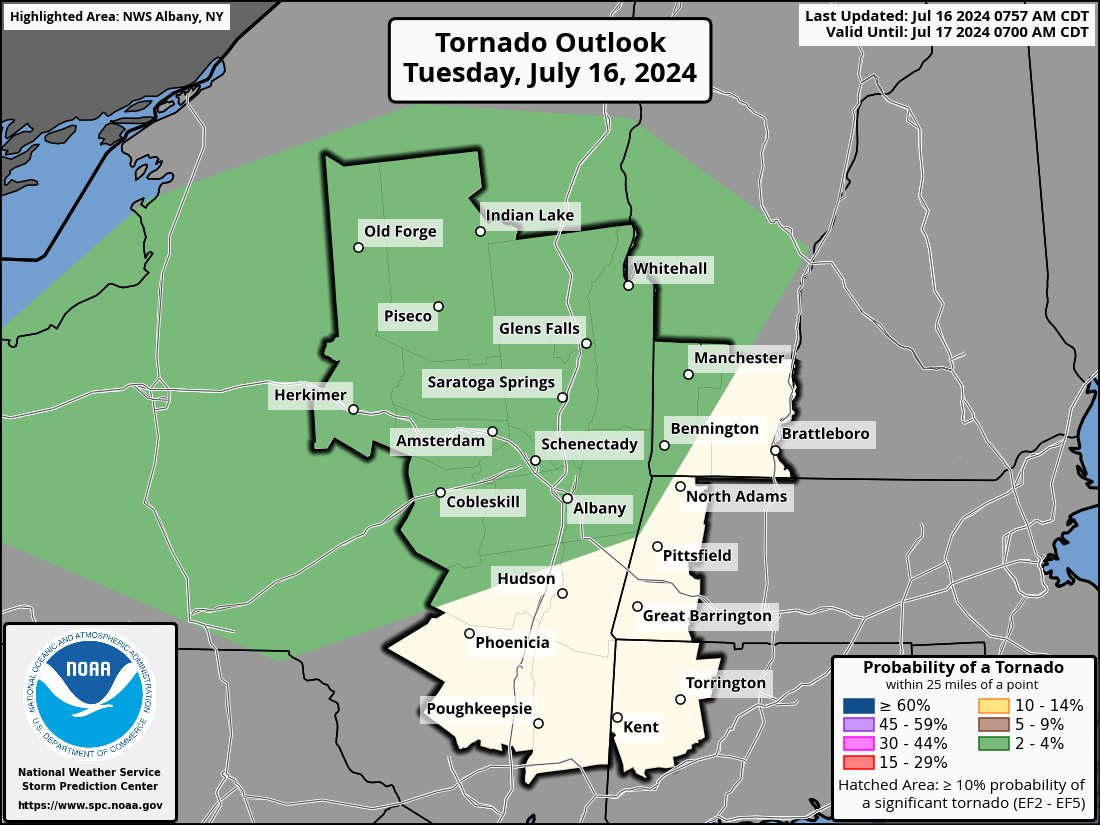
We've seen our share of severe weather this summer and it sounds like it will continue Tuesday afternoon and evening. In addition to a Heat Advisory, the National Weather Service is warning of strong storms with the potential for damaging winds, hail and lightning.
Tuesday's weather could also create conditions for a tornado possible in some areas.
Timing of the storms is expected to be in the mid to late evening, approximately 5pm to 7pm.
 ‘Bridgerton’ Star to Speak at Russell Sage College Commencement
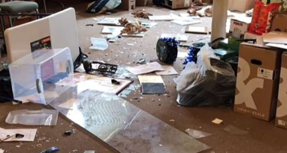 [PHOTOS/VIDEO] Vandals Destroy Saratoga County Museum
 Two Popular Albany Restaurants Up for Sale
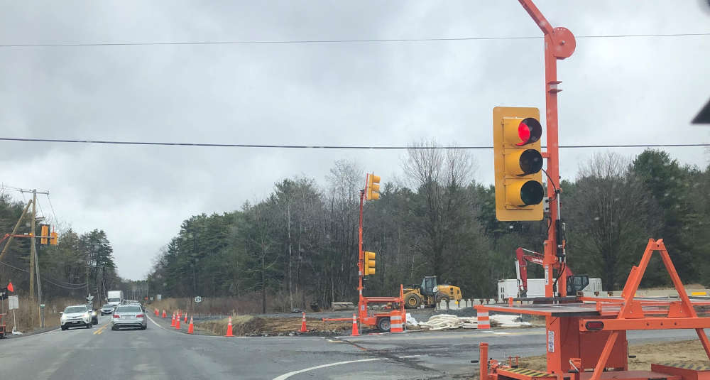 Saratoga County Road to Close This Week
 Useful Information To Get The Most Out of Wing Fest!